
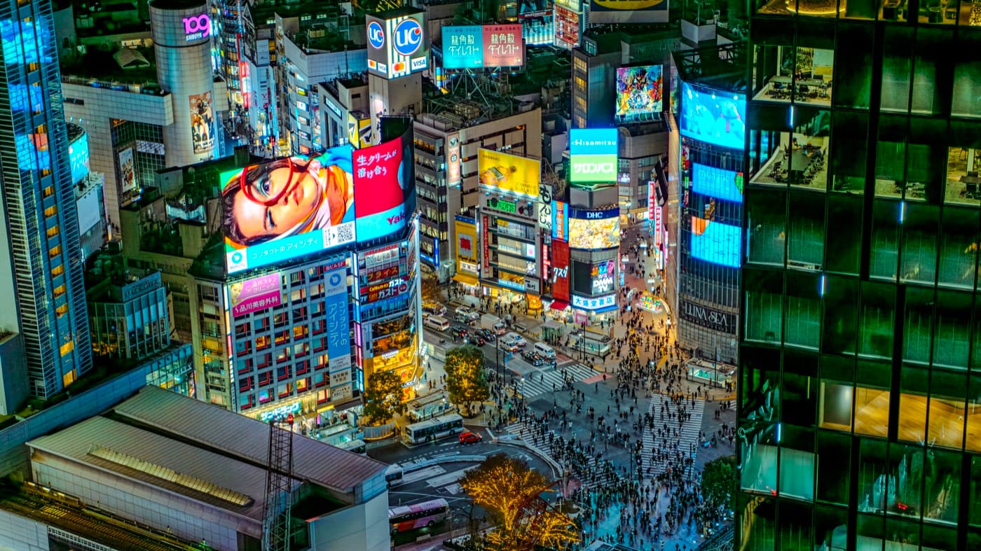
 Photo: David Kernan via Wikimedia Commons (CC BY 4.0)
Japan Live Camera Guide: How to Use Webcams to Plan a Smarter Self-Guided Trip
See what Japan looks like right now — is Fuji out, how crowded is Shibuya, is the typhoon really hitting? The best free live cameras by region, plus the brand-new map service that puts 1,383 of them in one place.
You've booked the flights. The itinerary is half-drafted. Now the real question: what does Japan actually look like right now, at this exact hour? A Japan live camera can answer that in about ten seconds, and it's one of the most underused planning tools for self-guided travelers.
This guide walks through the best Japan webcam sources by region, how to fold them into a real itinerary, and the mistakes that trip people up. No fluff — just what a live cam can and can't do for your plan.
Tomarigi ("Tomarigi World"): 1,383 Japanese Live Cams on One Map
Here's something the English-language travel sites haven't picked up yet. On August 17, 2026, a Japanese developer released Tomarigi (とまり木 — "the perch"), a free web service that plots 1,383 Japanese YouTube live cameras on a single interactive map. Instead of hunting stream by stream, you pan around Japan and click whatever catches your eye — a fishing port in Hokkaido, a shopping street in Kyushu, a mountain pass in the Alps.
🗾 Why this changes the game for trip planning
The service went viral in Japan within days — and one of the most repeated reactions was travellers using it to choose where to go next. The interface is Japanese, but the map needs no translation: zoom, click, watch. It's the fastest way we know to window-shop a region of Japan you've never considered, and it surfaces hundreds of small-town cams that never appear in English webcam directories.
One naming note: as the service spread on social media in late August it started being shared as "Tomarigi World" — same thing, one site. There is no app to install: it runs in any browser at tomarigi.me, on your phone included. Bookmark it alongside the classic English-friendly sources below — Tomarigi for discovery, the dedicated feeds for the big checks (Fuji, Shibuya, airports).
What a Japan Live Camera Actually Shows You
A Japan live camera is a public stream, usually hosted on YouTube or an operator's website, broadcasting a fixed view of a landmark, street, coast, airport or mountain. Most are free. Most run 24/7. You click, you watch, you move on.
For a self-guided trip that's a small superpower: you see current weather, real crowd levels, and whether Fuji is even out today. Fuji is fully visible only roughly a third of days, so a ten-second webcam check can save you a wasted day trip. Guidebook photos are shot in perfect light on perfect days; live cams show what's actually happening — and that difference is huge when you're deciding whether to spend three hours on a train to Kawaguchiko or pivot to Kamakura instead.
Mt Fuji Live Cameras: The Most Useful Feeds
Mount Fuji is the classic use case. It's shy, it hides behind clouds, and it's a long day trip from Tokyo.
North Side (Yamanashi)
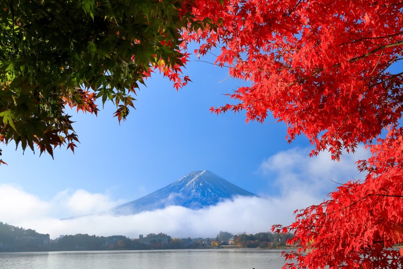
Cameras around the Fuji Five Lakes tend to clear earlier in the morning. If your plan involves Chureito Pagoda, Oshino Hakkai or the Kawaguchiko area, watch these first thing — the 4K stream from the Mt. Fuji Panoramic Ropeway in Fujikawaguchiko, showing Lake Kawaguchiko, Fuji and the Aokigahara forest, basically tells you whether the whole trip is worth doing today. (Planning that trip? Our Kawaguchiko transport guide covers every bus and train option.)
South Side (Shizuoka)
Cameras around Hakone, Gotemba, Fujinomiya and the Shonan coast catch the mountain backlit by the sun — good for afternoon plans, and for anyone combining Fuji with an Odawara or Hakone loop. The Shizuoka prefectural government maintains several official webcams on the southern face, embedded on its tourism portal.
The Summit Cam
There's a live camera at the highest point in Japan — the former weather station on Kengamine Peak, 3,776 m — streaming 24 hours on YouTube during the climbing season. Mostly a fun one to watch before your climb; don't expect summit footage in February.
How to Read the Feed
Don't just glance and go. When you're unsure, check two or three cameras facing the same side — a single cam can be blocked by local cloud while the mountain is clear a short distance away. That tip alone has saved us a couple of pointless train rides.
Tokyo Webcams: Shibuya, Airports, and the Skyline
Shibuya Scramble Crossing
The famous one — the view at the top of this page is roughly what the cams see. Shibuya Crossing handles an estimated 2,500–3,000 people per light cycle at peak, up to around 500,000 pedestrians a day, with the most dramatic crowds between 6 and 9 pm and on Friday and Saturday nights. If your itinerary includes Shibuya at night, glance at the cam around dinnertime and time your own photo accordingly.
Haneda and Narita
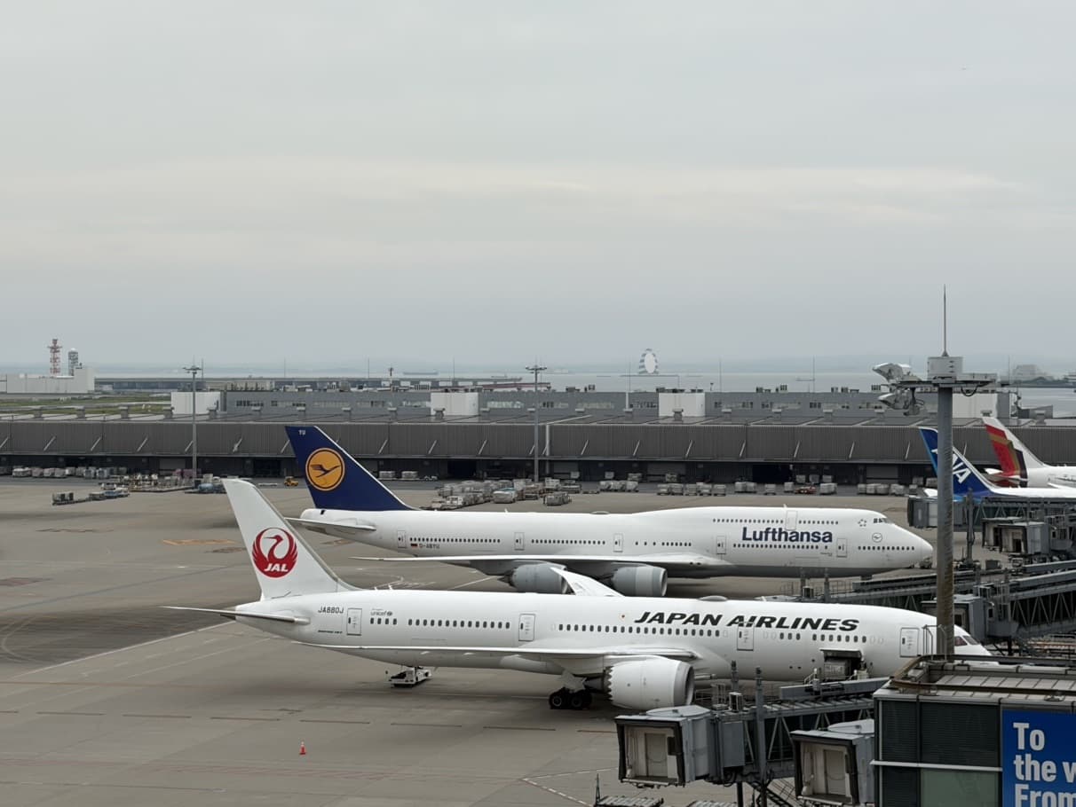
Haneda sits about 14 km south of central Tokyo with three terminals (T1 and T2 mostly domestic — JAL at T1, ANA at T2, with some ANA international also at T2 — and T3 the main international terminal). Plane spotters love the Haneda cams; jet-lagged arrivals use them to preview the landing weather. For Narita, the HD webcam from Sakuranoyama Park overlooks Runway A and the first terminal — useful for checking whether a storm is actually disrupting operations before you head out. Airport cam networks like AIRLIVE also cover Fukuoka, Sapporo, Naha, Osaka, Aomori, Nagasaki and Obihiro.
Kyoto, Osaka, Okinawa, Hokkaido
Kyoto is quieter cam territory but it exists — feeds cover stations, streets and seasonal views. Use them to gauge cherry blossom bloom, autumn colour and morning crowds before a sunrise run at Fushimi Inari.
Osaka: a cam pointed at Dotonbori shows the Glico Man, the canal and the crowd density — practical stuff. Expressway and skyline cams earn their keep in typhoon weather.
Okinawa: beach cams show wave state, wind and sky across the Ryukyu Islands — a lifesaver the morning of a snorkelling day, because Okinawa weather flips fast and the cams give the honest picture the forecast sometimes misses. In storm season, pair them with our typhoon tracker guide.
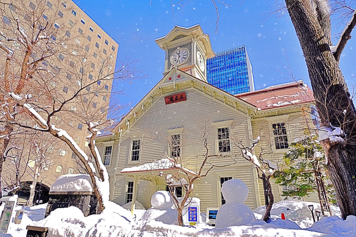
Hokkaido: peak winter content — Sapporo cityscape streams, ski-resort feeds and station views let you check snowfall in real time before a Snow Festival or ski trip. And the single most charming feed in Japan might be the Jigokudani snow monkey park's official live camera in Nagano — the rangers also post a daily "monkey forecast," and checking both before you set out is exactly how the park itself recommends planning a visit.
Best Sources to Bookmark
- Tomarigi — the new map of 1,383 YouTube cams across Japan. Best for discovery and small-town views.
- NHK — Japan's national broadcaster runs a reliable, high-quality Mt Fuji stream.
- Weathernews — a live Fuji camera paired with real-time meteorological data.
- SkylineWebcams — broad English-friendly coverage of cities, airports and landmarks.
- YouTube Live — search "[place name] live cam" and you'll find dozens of 24/7 streams.
- Prefectural tourism sites — official cams, like Shizuoka's southern-face Fuji feeds.
The 5-Step Playbook: Turning Views Into an Itinerary
1. Shortlist your Fuji day
Look at the 10-day forecast. Pick two candidate days.
2. Morning check
On the day, open two north-side cams and one south-side cam. If the summit is sharp on at least two, go.
3. Pivot ready
Have a plan B — Kamakura, Nikko, Enoshima. A 7 a.m. cam check gives you time to switch.
4. Crowd calibration
For Shibuya, Dotonbori or Arashiyama, a quick glance shows real-time density. Shift your visit earlier or later.
5. Airport buffer
Typhoon inbound? A Haneda or Naha cam tells you if it's chaos or business as usual.
That's it. No app to download, no login, no fee.
Common Mistakes Travelers Make With Live Cams
- Trusting one cam. Local clouds move. Check multiple.
- Watching too late. Fuji can clear or cloud over within an hour. Forecast → morning weather → cam check just before you leave.
- Ignoring seasonality. The summit Fuji cam only runs in climbing season (July to early September).
- Forgetting time zones. Japan is UTC+9. A pitch-black cam might just be showing 3 a.m.
- Treating cams as a booking tool. They're a check, not a control panel. You still need real reservations for Shinkansen seats, ryokan and popular sights.
Seasonal Notes: When Cams Matter Most
- Winter — Hokkaido snow cams, the Fuji snow cap, northern airport weather — and the snow monkeys, live.
- Spring — bloom tracking across Tokyo, Kyoto and Osaka alongside the cherry blossom forecast.
- Summer — typhoon monitoring for Okinawa and Kyushu, plus Fuji climbing conditions.
- Autumn — foliage timing in Kyoto and Nikko; cams beat any static forecast for peak colour.
💬 From our Japan travel team
The whole point of a self-guided trip is that you can react — chase clear skies to Fuji today, dodge a Kyoto rainstorm tomorrow, hit Dotonbori at its neon best on Friday. We build itineraries with that flexibility in, and a two-minute cam check each morning is how our travellers use it. Watching the feed is fun; standing in the place it points at is better.
Planning a trip to Japan and want help choosing where and when to go? Get in touch through Plan My Trip on our self-guided tours site, and we'll suggest the tours that best fit your dates and plans.
FAQ: Japan Live Cameras
Are Japan live cameras free to watch?
Yes. Nearly all public feeds run free on YouTube Live or operator websites — no login, no app. They also play in any mobile browser.
Is there a Tomarigi app? (Tomarigi World)
No app — and you don't need one. Tomarigi (shared on social media as "Tomarigi World") is a website that runs in any browser, phones included. If an app store listing claims to be Tomarigi, it isn't the real service.
What is Tomarigi?
A free web service released on August 17, 2026 that maps 1,383 Japanese YouTube live cameras onto one interactive map. The interface is Japanese, but the map itself needs no translation — zoom, click, watch. Best tool going for discovering views beyond the famous spots.
How accurate is a webcam for weather?
Very, for right now; less so for later. Wind and cloud shift fast near coasts and mountains. Use cams together with a forecast, not instead of one.
What's the best cam for Mt Fuji?
There isn't one single best. The Kawaguchiko-area streams and NHK's feed are favourites — cross-check two or three cams facing the same side, since Fuji is fully visible only about a third of days.
Are there live cams for smaller Japanese cities?
Yes — this is exactly where Tomarigi shines, surfacing hundreds of small-town and rural cams that never make the English directories. Most smaller cities have at least a station or civic cam.
Can I use webcams to check crowds at temples?
Sometimes. Many temples don't have their own cams, but nearby street or station cams give a decent proxy for how busy the area is.
Turn a Live View Into a Real Trip
If you're building a self-guided Japan itinerary and want routes, station-level transit tips and day-by-day plans that actually flex around the weather, that's what selfguidejapan.com does. Browse the region guides, map your cities, and use the live cams as your final gut check on the morning of.
Tomarigi (released August 17, 2026; 1,383 mapped cameras at launch) per the developer's announcement and Japanese press coverage; camera counts change as streams come and go. Fuji visibility (~one third of days), Shibuya crossing volumes and airport details per commonly cited public statistics and operator information. Individual streams start and stop without notice — if a feed named here is offline, search the location plus "live cam" on YouTube for its replacement. Hero photo: David Kernan via Wikimedia Commons (CC BY 4.0). Last updated: August 31, 2026.
Related Articles
Japan Typhoon Tracker 2026: Latest Track, Live Tools & the Season Outlook
15 min read
Japan Cherry Blossom Forecast 2027: The Practical Planning Guide for Self-Guided Travelers
14 min read
Japan Autumn Leaves Forecast 2026: Latest Dates City by City, and Where the Colors Are Now
14 min read